
I use an inreach mini if I had to send an email or text (Normally do not) but more for SOS as where I ski very very rarely has cell coverage.
For Nav I agree with the above- ALWAYS have a paper (plastic sheet?) map and a compass (no matter what else you have)- and know how to navigate with a map and a compass!!! Many do not! Use a GPS also- either a Garmin (I hate them) or your phone with a good one- Gaia is excellent- even in Europe. My phone the Samsung Xcover Pro has changeable batteries and they are big ones, I carry three spares. It is also waterproof, dustproof, and shock-proof to some obscure mil spec...and it works at -30c w/o any problems. No matter where you go...there you are
PS If you are in Norway use the free Hvor? app. "Hvor" means where in Norse. With that you can always get at least your location on super detailed topos- has overlapping map coverage for most places in Sweden or Finland you would ski too. You can get it on MS store and apple store. You can download your maps on it for off-line use. Hvor is free.
GPS/PLB, Mapping, and Navigation
-
randoskier
- Posts: 1242
- Joined: Mon Oct 31, 2016 2:08 am
- Location: Yank in Italy
- Ski style: awkward
- Favorite Skis: snow skis
- Favorite boots: go-go
- Occupation: International Pop Sensation
-
mca80
- Posts: 1090
- Joined: Sun Jan 02, 2022 5:24 pm
- Location: Da UP eh
- Ski style: Over the river and through the woods
- Favorite Skis: Nansen, Finnmark, Kongsvold, Combat NATO, Fischer Superlite, RCS
- Favorite boots: Crispi Bre, Hook, Alpina 1600, Alico Ski March, Crispi Mountain
Re: GPS/PLB, Mapping, and Navigation
I know I was the "first responder" to this thread with a simplistic response. I've never used high tech but wanted to commend @TallGrass, @randoskier, et al who suggest non digital/electronic resources either as backup or preparation. Absolute most important. I've always wondered about how to contact someone if my route changes, so this thread has been helpful, but I still don't think I would invest any money in anything. My routes are such that if need to be changed don't need to be changed drastically. I got "lost" backpacking just once in my life, in high terrain when there was snow on the ground, the "trail" was unable to be followed, fog was so thick I couldn't see any other ridges let alone 30 ft in front of me. But I knew roughly what time it was, could vaguely see where the sun was beyond the fog, and knew the lay of the land from studying maps so knew which direction to go, and when I started going downhill felt increasingly at ease and then totally at ease when I found a creek I knew would lead me back down the mtn to where I needed to go or at least close.
-
lowangle al

- Posts: 2819
- Joined: Sat Jan 11, 2014 3:36 pm
- Location: Pocono Mts / Chugach Mts
- Ski style: BC with focus on downhill perfection
- Favorite Skis: powder skis
- Favorite boots: Scarpa T4
- Occupation: Retired cement mason. Current job is to take my recreation as serious as I did my past employment.
Re: GPS/PLB, Mapping, and Navigation
I take a Garmin mini in reach, mostly for medical emergencies. It really paid off last year, luckily it wasn't an emergency. I was out on a solo canoe trip and was able to text my wife that I was extending my stay, after deciding I wasn't ready to come home. It's also good to know that if there was an emergency at home I could be contacted.
On another note, I was in the middle of a frozen swamp using the compass on my iphone when it froze up. I found my way out, but was nervous that if I broke through the ice and got a wet foot and had to spend a night out there it could have been serious.
On another note, I was in the middle of a frozen swamp using the compass on my iphone when it froze up. I found my way out, but was nervous that if I broke through the ice and got a wet foot and had to spend a night out there it could have been serious.

Re: GPS/PLB, Mapping, and Navigation
Under PLB, to get "Personal(ly) Located", GPS coordinates are good, a signal to home in on is great, but there's something to be said for "making visual/auditory contact" in the field with SAR.
An old school battery-free for those in the area or even far off is a good whistle (e.g. Fox 40, ref whistle, etc.). My small packs have one integrated into the chest belt. Various stories of not being able to hear shouts, but SAR could hear the whistle.
Visually, I've heard some pack a high-quality laser that shines X distance. Can't advise brand nor model, but it can be used to flash aircraft overhead (briefly, wave back and forth) or SAR on ground, and they can follow beam path back if you're not on a line of sight but can shine it on something they can see.
I've looked at Fenix flashlights, yet to spring for one.
There's lumens/candela (light output) and then there's throw (distance). I've looked at these because I've been on a mountain ridge at night unable to penetrate the shadow side with my headlamp to scout the terrain. Some have a USB port for recharging (think battery brick or motor vehicle en route). These could serve as a lamp in every day use, and as a "localizer" for SAR or merely showing your hiking partner arriving after dark where you made camp. "Hey, Tele-T-Rex, can you turn on the runway lights for me?"
200-300+ meters throw seems common.
PD36R PRO (USB-C port for recharging), roughly 1" dia x 5.75" long


E35R (USB-C port)

If you want to have even more through (and be able to blind any animal), look at white lasers that use a LEP (laser excited phosphorus) and well set you back $280 and change like the Fenix HT30R or TK30. The report a throw of 1.2-1.5 kilometers. (Jedi training not required.)
TK30

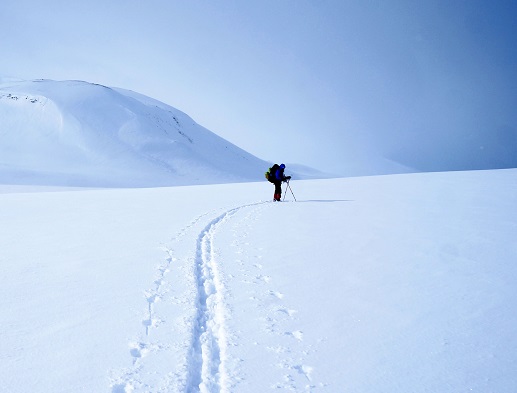
I can relate to the photo below:

HT30R ("1,500 meters", USB-C port)

An old school battery-free for those in the area or even far off is a good whistle (e.g. Fox 40, ref whistle, etc.). My small packs have one integrated into the chest belt. Various stories of not being able to hear shouts, but SAR could hear the whistle.
Visually, I've heard some pack a high-quality laser that shines X distance. Can't advise brand nor model, but it can be used to flash aircraft overhead (briefly, wave back and forth) or SAR on ground, and they can follow beam path back if you're not on a line of sight but can shine it on something they can see.
I've looked at Fenix flashlights, yet to spring for one.
There's lumens/candela (light output) and then there's throw (distance). I've looked at these because I've been on a mountain ridge at night unable to penetrate the shadow side with my headlamp to scout the terrain. Some have a USB port for recharging (think battery brick or motor vehicle en route). These could serve as a lamp in every day use, and as a "localizer" for SAR or merely showing your hiking partner arriving after dark where you made camp. "Hey, Tele-T-Rex, can you turn on the runway lights for me?"
200-300+ meters throw seems common.
PD36R PRO (USB-C port for recharging), roughly 1" dia x 5.75" long
E35R (USB-C port)
If you want to have even more through (and be able to blind any animal), look at white lasers that use a LEP (laser excited phosphorus) and well set you back $280 and change like the Fenix HT30R or TK30. The report a throw of 1.2-1.5 kilometers. (Jedi training not required.)
TK30
I can relate to the photo below:
HT30R ("1,500 meters", USB-C port)

Re: GPS/PLB, Mapping, and Navigation
I navigate with a paper (or these days, usually plastic) topo map. I generally study the map pretty closely before the trip. I carry a compass, but it's been at least 25 years since I used it for navigation since I am nearly always in mountainous terrain where the topo and paying attention tells me where I am. I sometimes use the compass when I am looking at a view from a high point to orient the map accurately enough to identify the various peaks I am looking at. Haven't tried a GPS.
I carry an Inreach Mini because my wife wants me to, but I maintain the stance that I am never using it unless I am injured enough to be unable to walk/ski out to a road. I had a bad experience with a SPOT that my friend had, where the outgoing messages were not going out, everybody at home freaked while we were fine. So no status updates for me, I don't want anyone expecting a message and then not getting one because of a canyon, or too much cloud cover, or trees, or whatever.
I carry an Inreach Mini because my wife wants me to, but I maintain the stance that I am never using it unless I am injured enough to be unable to walk/ski out to a road. I had a bad experience with a SPOT that my friend had, where the outgoing messages were not going out, everybody at home freaked while we were fine. So no status updates for me, I don't want anyone expecting a message and then not getting one because of a canyon, or too much cloud cover, or trees, or whatever.
-
fgd135
- Posts: 531
- Joined: Sun Jan 19, 2020 2:55 pm
- Location: Colorado
- Ski style: Yes, sometimes.
- Favorite Skis: Most of them
- Favorite boots: Boots that fit
- Occupation: Yes
Re: GPS/PLB, Mapping, and Navigation
When I'm out backcountry ski patrolling I carry a patrol provided SPOT-X unit and satellite phone, a cell phone loaded with maps, a patrol Motorola two way radio with about 12 channels, inc. our channels, several different law enforcement agencies, the USFS, MRA channels and local fire channels, plus helitac support. And always real maps and a really good compass that I know how to use, not one of those little tiny zipper bauble things. Using one or more of these gives us many comm options and nav options. And I check in automatically every few minutes during the patrol day by the SPOT, in real time, on the web, so if I get stuck or lost or need an assist other patrollers can get the coordinates right away. In Reach of course does this as well.
The Motorola radios are limited in range and are really useful only with other patrollers in the same vicinity and when meeting other agencies responding in the field. It's the Spot and the sat phone that do the real work. And the real maps.
Out just skiing around for fun (although patrolling is fun), a personal Garmin Inreach, the cell phone, and always maps and a good compass. I turn off the cell phone to keep it warm and charged, and only turn it on if I think I need to use it, which is basically never, but ya can't be sure.
"To me, gracefulness on skis should be the end-all of the sport" --Stein Eriksen
-
randoskier
- Posts: 1242
- Joined: Mon Oct 31, 2016 2:08 am
- Location: Yank in Italy
- Ski style: awkward
- Favorite Skis: snow skis
- Favorite boots: go-go
- Occupation: International Pop Sensation
Re: GPS/PLB, Mapping, and Navigation
Not entirely sure I am down with the idea of a "backcountry ski patrol". One that skis around patrolling the backcountry? The idea of skiing the backcountry is not to see people, and if you go out there and have a clue what you are doing you don't need any help unless you are hurt/sick. In Norway and Swedish Lapland where we usually ski we see almost nobody ever and the ones we do run across know exactly what they are doing. If I needed a rescue the Red Cross would respond on skis or snowmobile or bring in a military/civil helicopter if needed. The Norges Røde Kors (Red Cross Norway) rescue is all volunteer and does not patrol at all, it is also free, including the chopper. What has happened to the land of "rugged individualists"? Of course maybe I am missing something, please enlighten me- what is the purpose of Backcountry Ski Patrol?fgd135 wrote: ↑Sun Mar 26, 2023 6:53 pmWhen I'm out backcountry ski patrolling I carry a patrol provided SPOT-X unit and satellite phone, a cell phone loaded with maps, a patrol Motorola two way radio with about 12 channels, inc. our channels, several different law enforcement agencies, the USFS, MRA channels and local fire channels, plus helitac support. And always real maps and a really good compass that I know how to use, not one of those little tiny zipper bauble things. Using one or more of these gives us many comm options and nav options. And I check in automatically every few minutes during the patrol day by the SPOT, in real time, on the web, so if I get stuck or lost or need an assist other patrollers can get the coordinates right away. In Reach of course does this as well.
The Motorola radios are limited in range and are really useful only with other patrollers in the same vicinity and when meeting other agencies responding in the field. It's the Spot and the sat phone that do the real work. And the real maps.
Out just skiing around for fun (although patrolling is fun), a personal Garmin Inreach, the cell phone, and always maps and a good compass. I turn off the cell phone to keep it warm and charged, and only turn it on if I think I need to use it, which is basically never, but ya can't be sure.
-
randoskier
- Posts: 1242
- Joined: Mon Oct 31, 2016 2:08 am
- Location: Yank in Italy
- Ski style: awkward
- Favorite Skis: snow skis
- Favorite boots: go-go
- Occupation: International Pop Sensation
Re: GPS/PLB, Mapping, and Navigation
The Norwegian Mapping Authority (similar to the USGS) has a great free app (with zero ads) called "Hvor?" which means "Where?" in Norwegian. It can be downloaded from Google Play or the Apple Store. You can download all of the official Norwegian 1:50000 topo maps (great quality maps that used to cost $250 from Garmin, I know- they are installed on my E-trex). You can down load by region. They are updated regularly.
They have now negotiated with Finland and Sweden to include the border area maps from those two countries which includes essentially anywhere you would want to ski in Sweden or Finland.
It is a really simple app no social media sharing and all that clutter crap. I think they added tracking to it recently so you can record tracks- however I don't do this, waste of precious battery on a long tour (I just bought another spare battery for my phone so I now have 4 replacement batteries for it, 2 weeks plus autonomy).
What I do like with Hvor? is that I can press a button and see exactly where I am, simple- I then use a paper map, because I can see a much larger area than on a screen, and I navigate with the trusty Suunto (Made in Finland) compass (pre-adjusted to declination). It is easy with the compass and map because I know exactly where I am to set my bearing from this point to my destination or next point.
If you are interested in seeing the terrain of Norway (Finland Sweden too) I suggest downloading it and playing with it. Free, no subscription, and no adverts. Just search- Hvor? in the app shops.
Re: GPS/PLB, Mapping, and Navigation
https://lmgtfy.app/?q=backcountry+ski+patrolNot entirely sure I am down with the idea of a "backcountry ski patrol". One that skis around patrolling the backcountry? The idea of skiing the backcountry is not to see people, and if you go out there and have a clue what you are doing you don't need any help unless you are hurt/sick. In Norway and Swedish Lapland where we usually ski we see almost nobody ever and the ones we do run across know exactly what they are doing. If I needed a rescue the Red Cross would respond on skis or snowmobile or bring in a military/civil helicopter if needed. The Norges Røde Kors (Red Cross Norway) rescue is all volunteer and does not patrol at all, it is also free, including the chopper. What has happened to the land of "rugged individualists"? Of course maybe I am missing something, please enlighten me- what is the purpose of Backcountry Ski Patrol?
https://www.google.com/search?q=backcou ... ski+patrol
FWIW, the second and third photos give an idea of what using clear-coated retro-reflective tape can do for passive visibility to either locate gear (cached, dropped, lost) or people. I've also done a band on the front, side and rear of my snowshoes ala the reflectors on bicycle pedals and it's made them easier to find where you cached them where the snow-zone switches to wind-scoured ridge talus during those short winter daylight hours.
Note poles in background in photos 2 and 3. First photo also has a retro-reflective band (uphill pass, pink edges) but it's the fabric (non-coated) type which doesn't reflect nearly as well.
https://telemarktalk.com/viewtopic.php? ... =20#p55837
-
fgd135
- Posts: 531
- Joined: Sun Jan 19, 2020 2:55 pm
- Location: Colorado
- Ski style: Yes, sometimes.
- Favorite Skis: Most of them
- Favorite boots: Boots that fit
- Occupation: Yes
Re: GPS/PLB, Mapping, and Navigation
Well, that's the difference, lots of US backcountry recreational nordic skiers and snowshoers have not a clue about they do, much less how to self rescue, and are often ill-equipped for emergencies. Most rely on cell phones that usually don't work out where they're recreating, and don't carry maps...We ski a lot, have fun, assist if needed, respond if needed. Not trail grooming, and not doing avalanche control work, but doing avalanche awareness courses for the public and a bit of trail maintenance here and there, plus the usual patrol stuff on the trails such as first aid, giving trail directions, and so on. Even nordic skiing, a few skiers run into trees and break faces, arms, legs, etc., and some, esp., snowshoers, seem to be unable to successfully navigate out of and back to the trailheads.randoskier wrote: ↑Mon Mar 27, 2023 6:18 am[q
Not entirely sure I am down with the idea of a "backcountry ski patrol". One that skis around patrolling the backcountry? The idea of skiing the backcountry is not to see people, and if you go out there and have a clue what you are doing you don't need any help unless you are hurt/sick. In Norway and Swedish Lapland where we usually ski we see almost nobody ever and the ones we do run across know exactly what they are doing. If I needed a rescue the Red Cross would respond on skis or snowmobile or bring in a military/civil helicopter if needed. The Norges Røde Kors (Red Cross Norway) rescue is all volunteer and does not patrol at all, it is also free, including the chopper. What has happened to the land of "rugged individualists"? Of course maybe I am missing something, please enlighten me- what is the purpose of Backcountry Ski Patrol?
Pretty common in the US to see cross country/nordic patrols in and out of nordic centers. Different world than yours, apparently.
Last edited by fgd135 on Mon Mar 27, 2023 5:55 pm, edited 1 time in total.
"To me, gracefulness on skis should be the end-all of the sport" --Stein Eriksen